

SURVIVAL MAP FIELD GUIDE
How to read a Scrap Mechanic Survival map
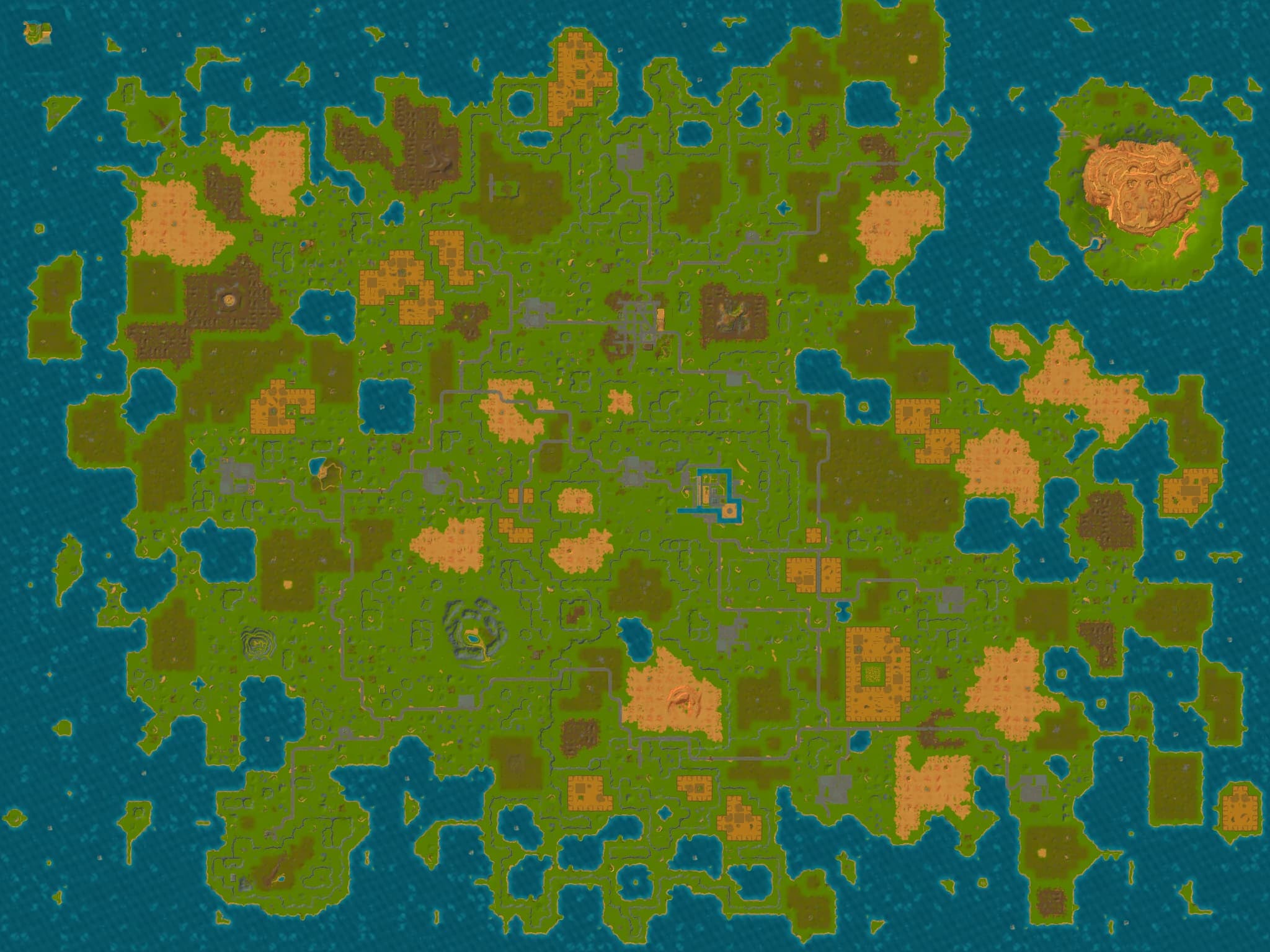
Players usually need a map for one of three decisions: finding a progression location, checking whether another player’s route applies to their seed, or turning a local save into a terrain overview. The map above supports those tasks, but only when exact terrain and general location guidance are kept separate.
Is every Survival map the same?
No single screenshot is a universal map of every Survival world. The world is generated from a save seed, so roads, biomes, coastlines, elevation, and many ordinary points of interest can differ. Version 1.0 also reworked terrain generation and added new locations, which makes pre-release map images especially unsafe as exact route plans.
Some major destinations still have accepted coordinates or stable area centers in the current world layout. That is why a useful map can guide you toward the Mechanic Station or a Growlab while still warning that the final road, slope, entrance, or nearby terrain may look different in your save.
Reference terrain and your save answer different questions
The default terrain is an exact render of one accepted reference save. It is useful for learning the scale of the world, the relative direction of major destinations, and how the location controls work. It does not prove that your roads, lakes, warehouses, or local terrain use the same arrangement.
Selecting your own Survival .db file replaces the terrain layer with a render made from that save. The browser reads and renders the file locally; the selected save and generated image are not uploaded or persisted by the map tool. This gives you seed-specific terrain without changing the save.
What the 14 location cards actually tell you
The current atlas covers the Crashed Ship, the Gyro-Core story destination, the Mechanic Station, the Hideout, vegetable and fruit Packing Stations, the Scrap Garage, and Growlabs 1–7. Their names and descriptions use the active game locale, so the card can be matched to the wording shown by the current game.
An exact marker is a coordinate that can be followed directly. An area-center marker identifies the accepted center of a destination area, not a promise that the doorway, road approach, vertical level, or quest interaction sits on that pixel. Select a card to center and zoom the map, then use the surrounding terrain as the final approach clue.
- Use the Crashed Ship and Gyro-Core exact markers as direct coordinate references.
- Treat service, trade, Scrap Garage, and Growlab pins as area guidance.
- Do not infer unlisted warehouses, resources, small ruins, or random encounters from the reference terrain.
Plan a route without turning the atlas into false GPS
Start with the decision that blocks progress: returning to the ship, reaching building services, delivering produce, following a quest, or preparing for a hostile Growlab. Compare the relevant cards, pick visible terrain or roads as intermediate landmarks, and leave enough fuel, food, and recovery margin for a different local approach.
The atlas does not track the live player, write waypoints into the game, calculate a safe path, reveal interior floors, or guarantee enemy and resource placement. It is strongest as a route-planning reference paired with the current quest state and what you can see in your own world.
Continue planning your Survival route
The terrain and location scope reflects the accepted 1.0.0.867 map dataset. Seed-specific entrances, roads, ordinary points of interest, live pathfinding, and runtime spawns are not presented as universal facts.